The Great Allegheny Passage (aka the GAP) is a 150-mile rail trail that connects downtown Pittsburgh, Pennsylvania to the western end of the Chesapeake and Ohio (C&O) Canal in Cumberland, Maryland. From there travelers with the time and motivation can continue for another 184 miles to Washington, DC on the canal’s tow path adjacent to the Potomac River. Earlier this month my friend Jeff and I took Amtrak’s Capitol Limited train from DC to Pittsburgh with our bikes in a baggage compartment, and started the Passage ride to Cumberland the next morning. At its Pittsburgh end the rail trail begins in a downtown park, at the point where the Allegheny and Monongahela Rivers join to form the Ohio River (which, in turn, joins the Mississippi almost a thousand miles downstream). Along our ride to Cumberland we passed over the Eastern Continental Divide, which separates river basins that flow to the Gulf of Mexico from those that flow east into the Atlantic. We took four days, riding between 33 and 43 miles a day. This was a leisurely pace by serious biker standards. A pair of brothers we met were riding all 334 miles to DC in four days (and an enthusiast named Chris Shue rode from Pittsburgh to DC in just under 24 hours a couple of years ago!). Along the way we stayed in a B&B (West Newton, PA), a guest house (Ohiopyle, PA), and at Donges Drive-In and Motel (Myersdale, PA), which is a bit like a motel, but is really unclassifiable!
The Passage trail winds alongside rivers, with many crossings along the way over old iron and steel train bridges that have been converted to trail use. Freight trains still run frequently along these rivers, passing at street grade through the small towns along the Passage trail. There’s an elevation profile of the 150-mile trail on the internet that shows a constant moderate upward grade for the 127 miles from Pittsburgh to Frostburg, PA – and then what looks like a steep slope running down the last 23 miles to Cumberland. Jeff and I spent a lot of time before and during the trip debating whether we would notice the downhill grade to Cumberland, because the elevation profile uses a scale that’s highly exaggerated. We did have to pedal on that final downhill leg, but it was easy going – suddenly we could breeze along at 15 mph without much effort at all – fantastic!
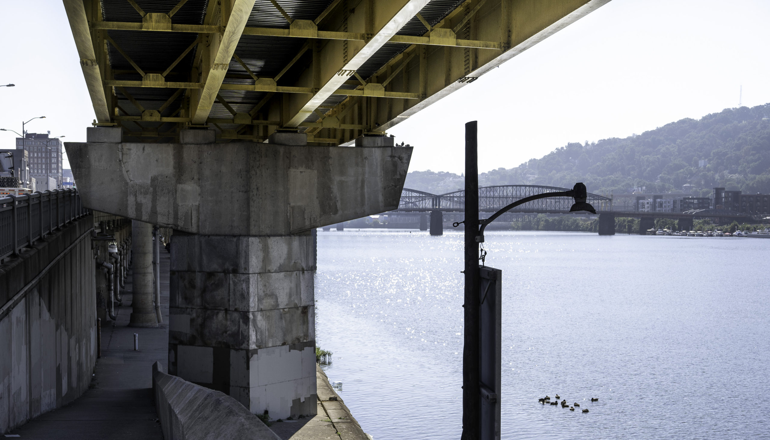
Day 1. Riding out of downtown Pittsburgh from the Passage trail’s western end at Point State Park, the trail follows the edge of the Monongahela River below interesting highway structures.
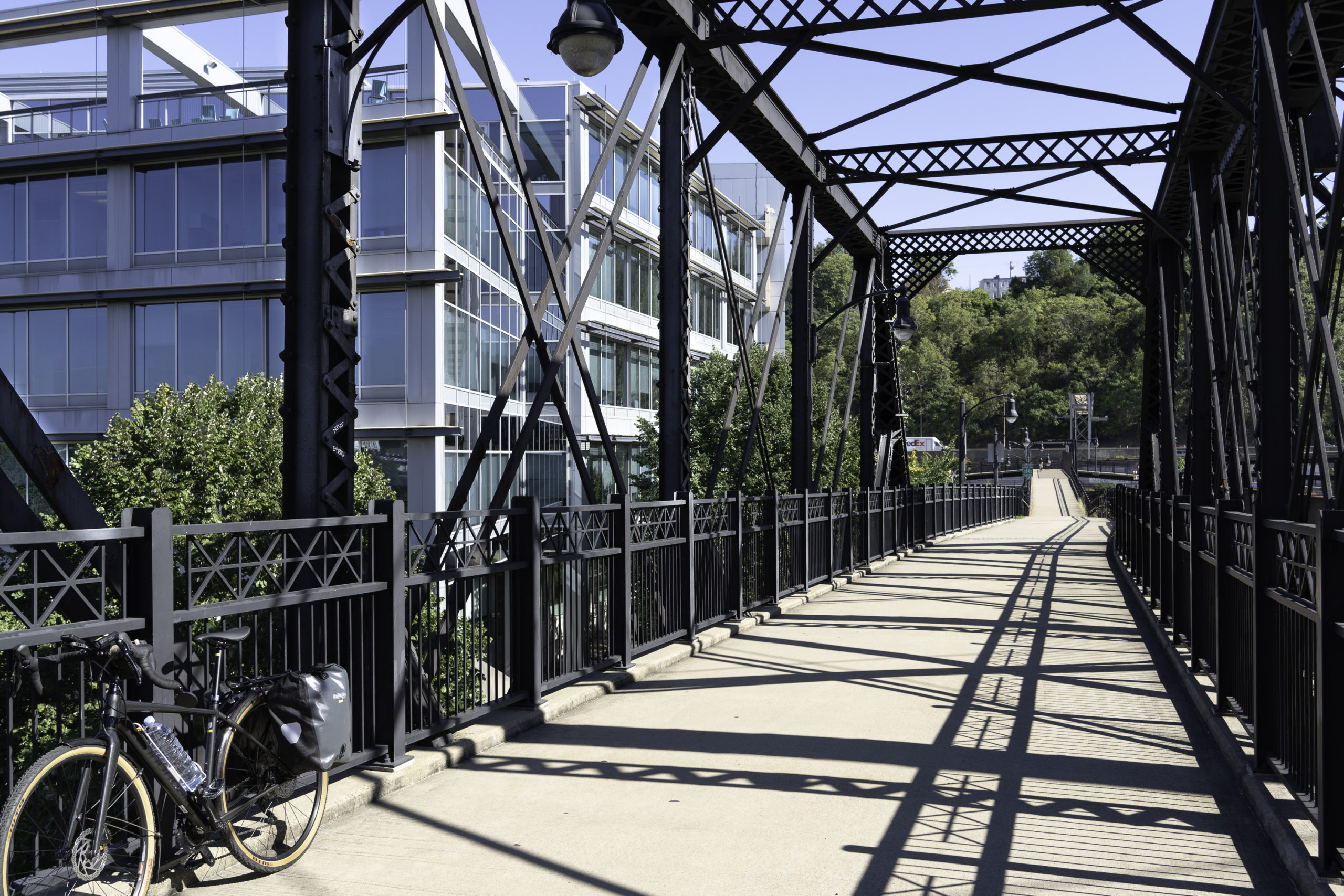
A few miles from downtown Pittsburgh the trail starts running through modern officescapes that have been built on the old industrial sites that once lined the Monongahela. It’s great to see how the city’s economy, once heavily steel-oriented, has transformed into a technology and medical hub.
There are plenty of bridges to look at and examine along the trail. The old rail bridges have largely been preserved, with decks and railings added for the Passage trail. Here we cross back over the Monongahela into McKeesport, where we stopped for lunch at Eat’n Park, a classic diner. Our waitress had been working at the place for 47 years!
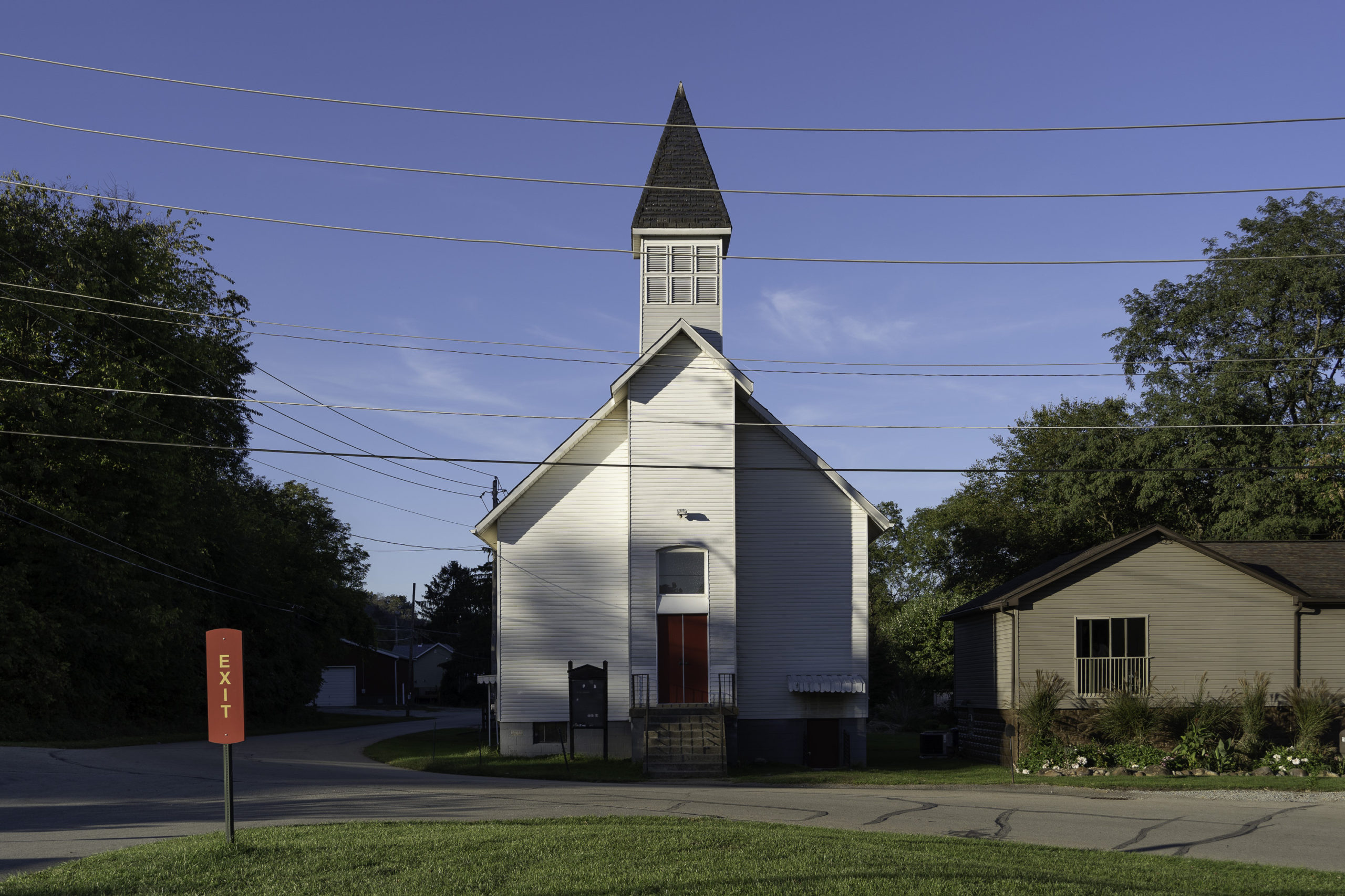
A simple church, next the trail not far from our first night’s stop, a B&B adjacent to the Youghiogheny River, just outside of the small town of West Newton.
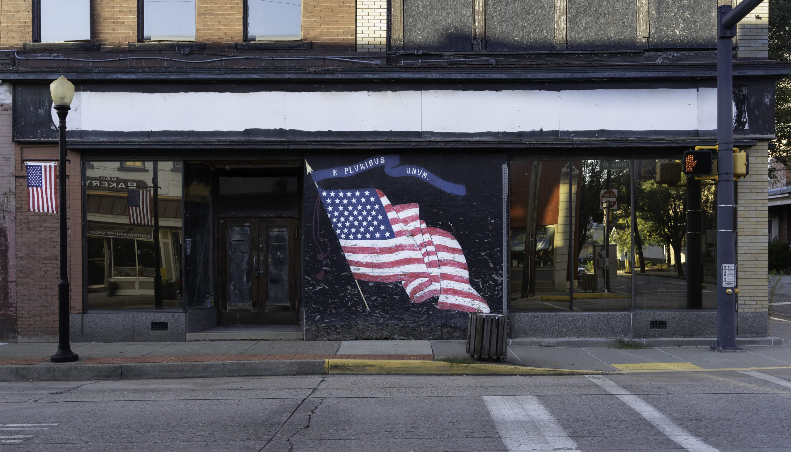
West Newton’s commercial downtown is only two blocks long, and businesses have mostly moved out. It was never a big town, with a population that peaked at about 4,000 in 1960 and has since fallen to about 2,500, the same as it was in 1900. Radiator and boiler manufacturing were once big in this town.
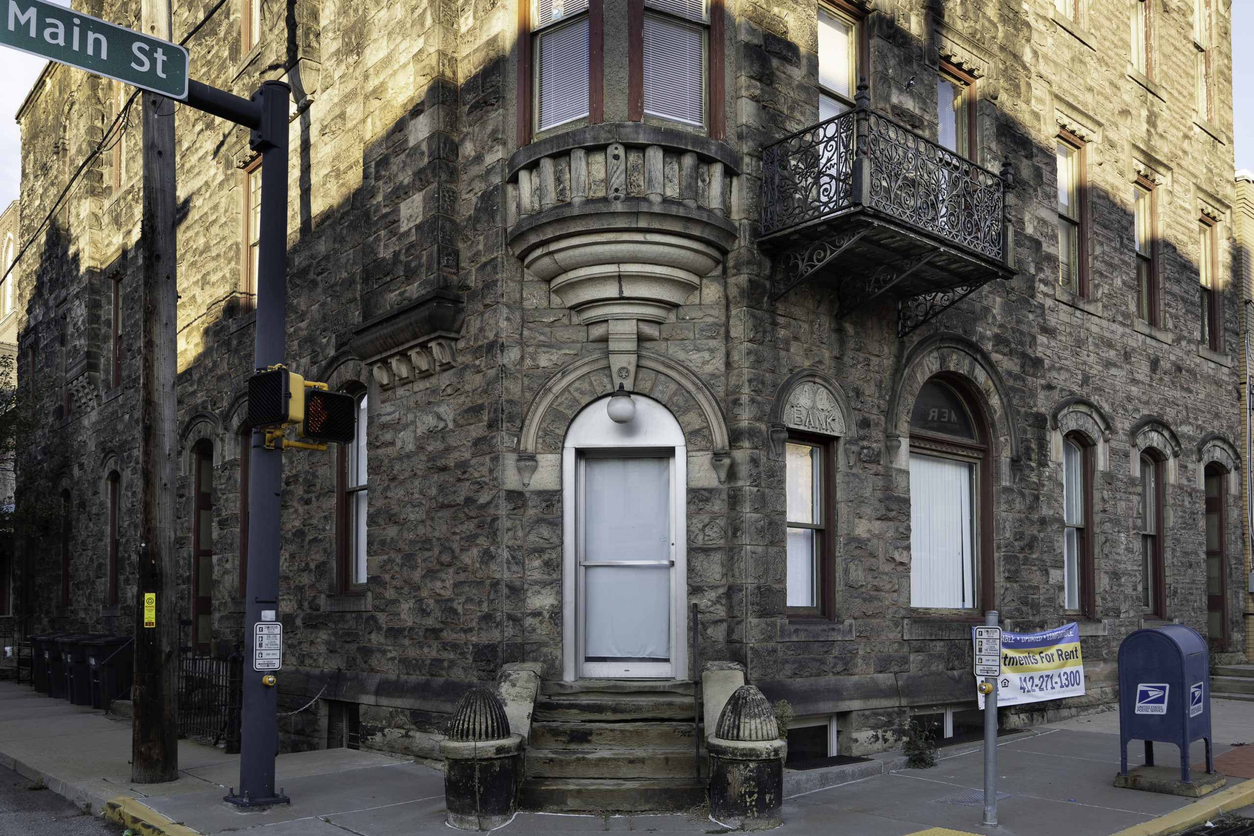
The largest building in town has an interesting rusticated stone facade. A carved sign for a long-gone bank remains over one window. Note the ironwork balcony – probably a later addition?
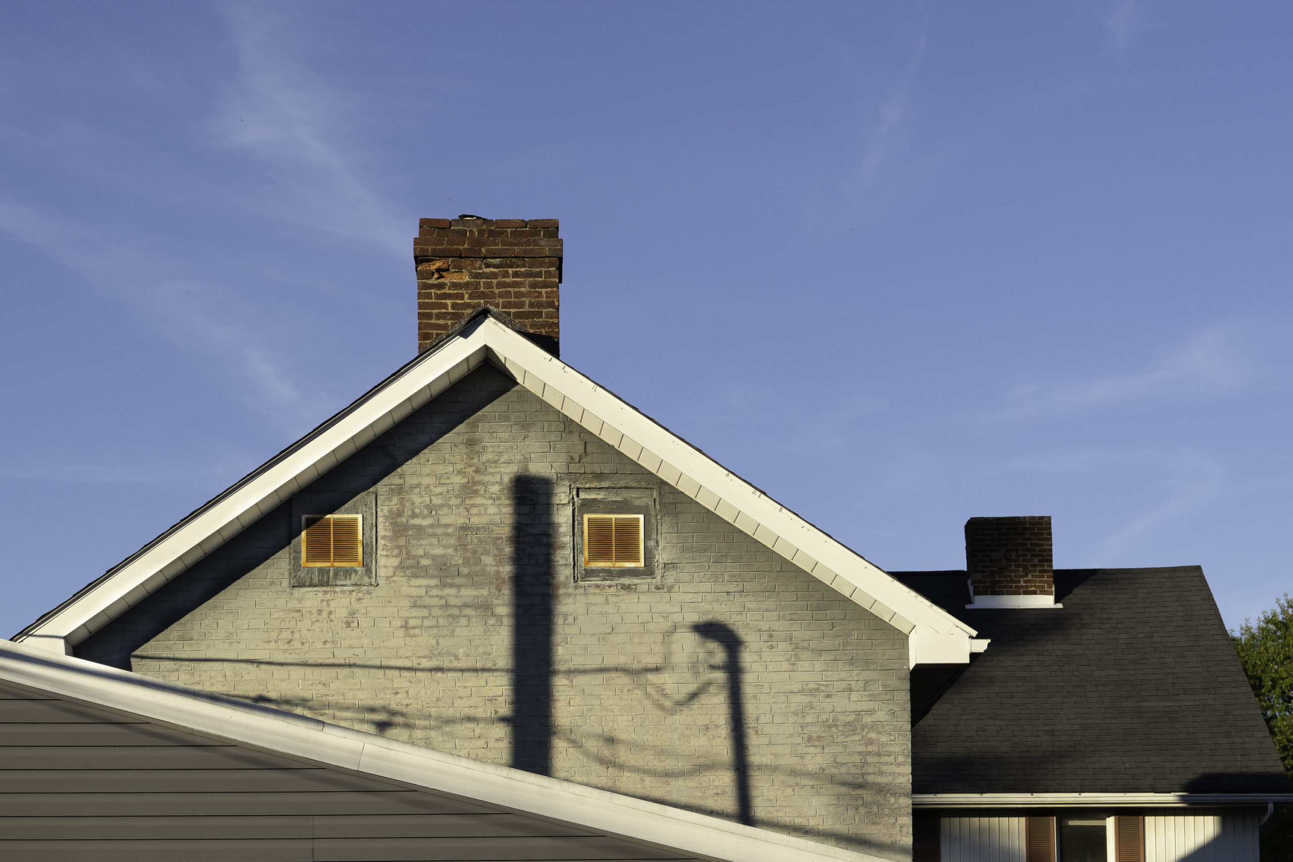
Sometimes a combination of lines and colors and textures catches your eye. Here, just off West Newton’s main street, shadows of poles and lines, rusted-red attic grills, the bright white roof edge, and the blue sky and chimneys join into one visual statement.
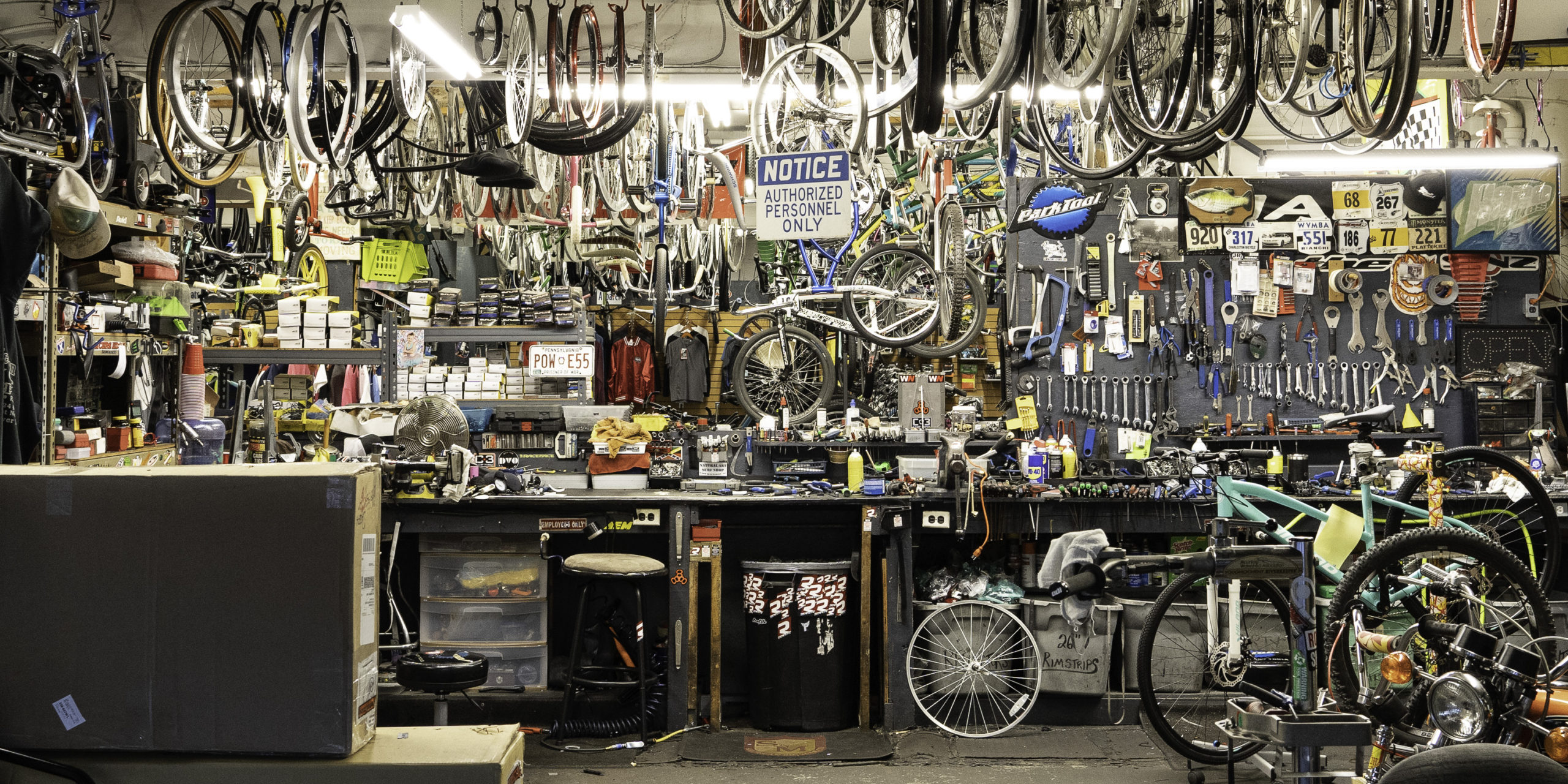
A bike rental’s work shop, tucked beneath the grill/pub where we had dinner, is a chaotic scene of wheels and parts and tools and bikes in repair.
The lime-green face of the B&B house shines brightly in the early morning sun. The day began with a thick layer of fog that lay over the river and close-by houses, but the fog lifted quickly.
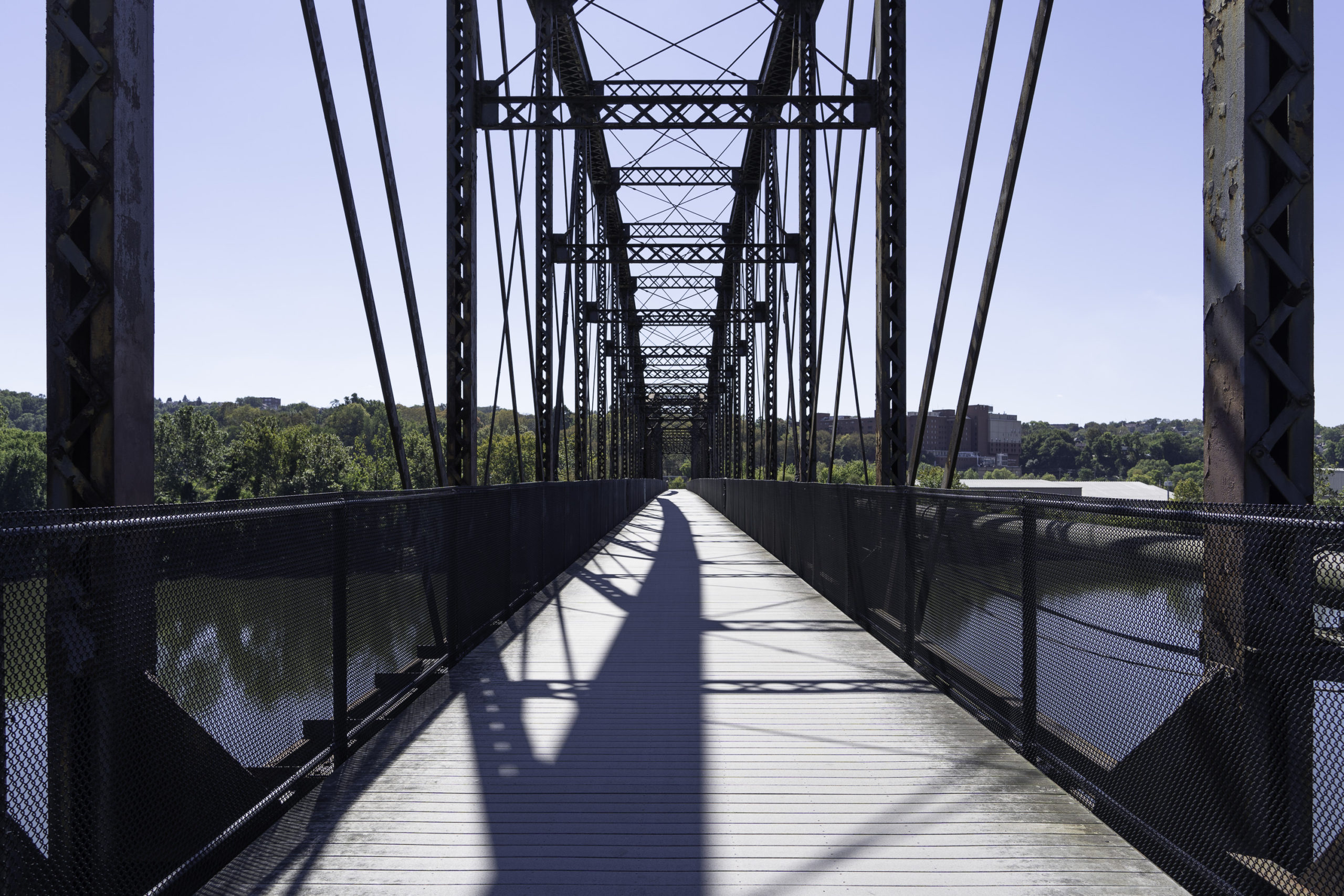
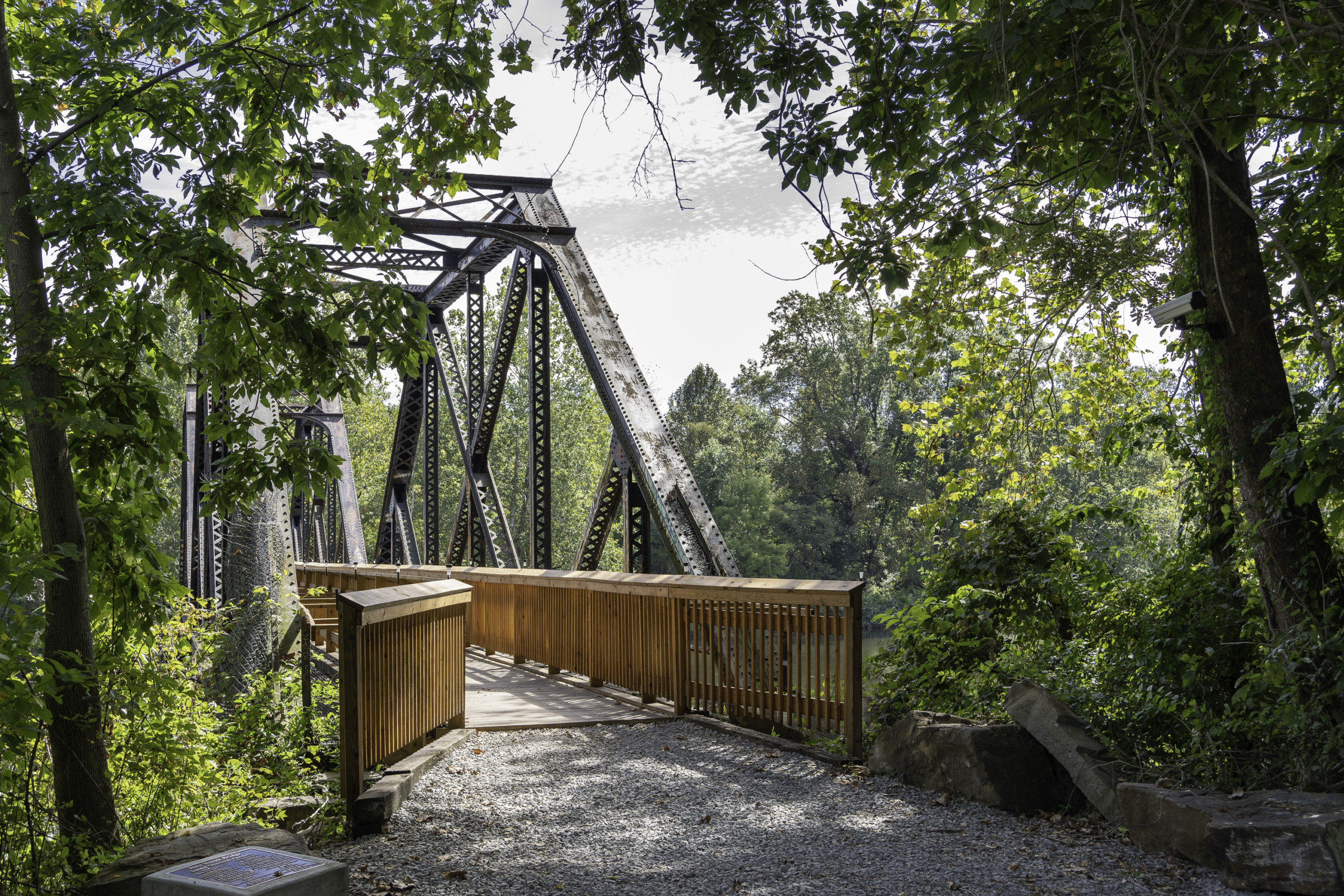
Wooden railings reach out from an old rail bridge to the forested trail. The surface of the well-maintained Passage trail is crushed stone, a great material for biking – it makes a nice crunching sound as you ride along.
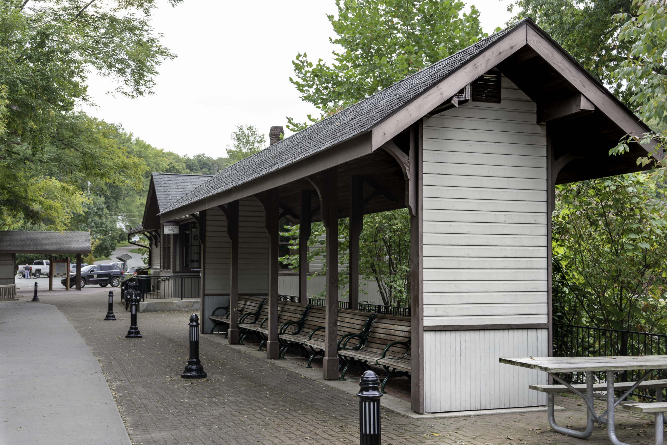
At the end of Day 2, Ohiopyle – another small town along the Youghiogheny River, with an old rail station and a canopied seating area. It’s one of a number of old stations along the Passage trail that have been converted to visitor centers and small museums. Two houses designed by Frank Lloyd Wright, Falling Waters and Kentuck Knob, are not far from town.
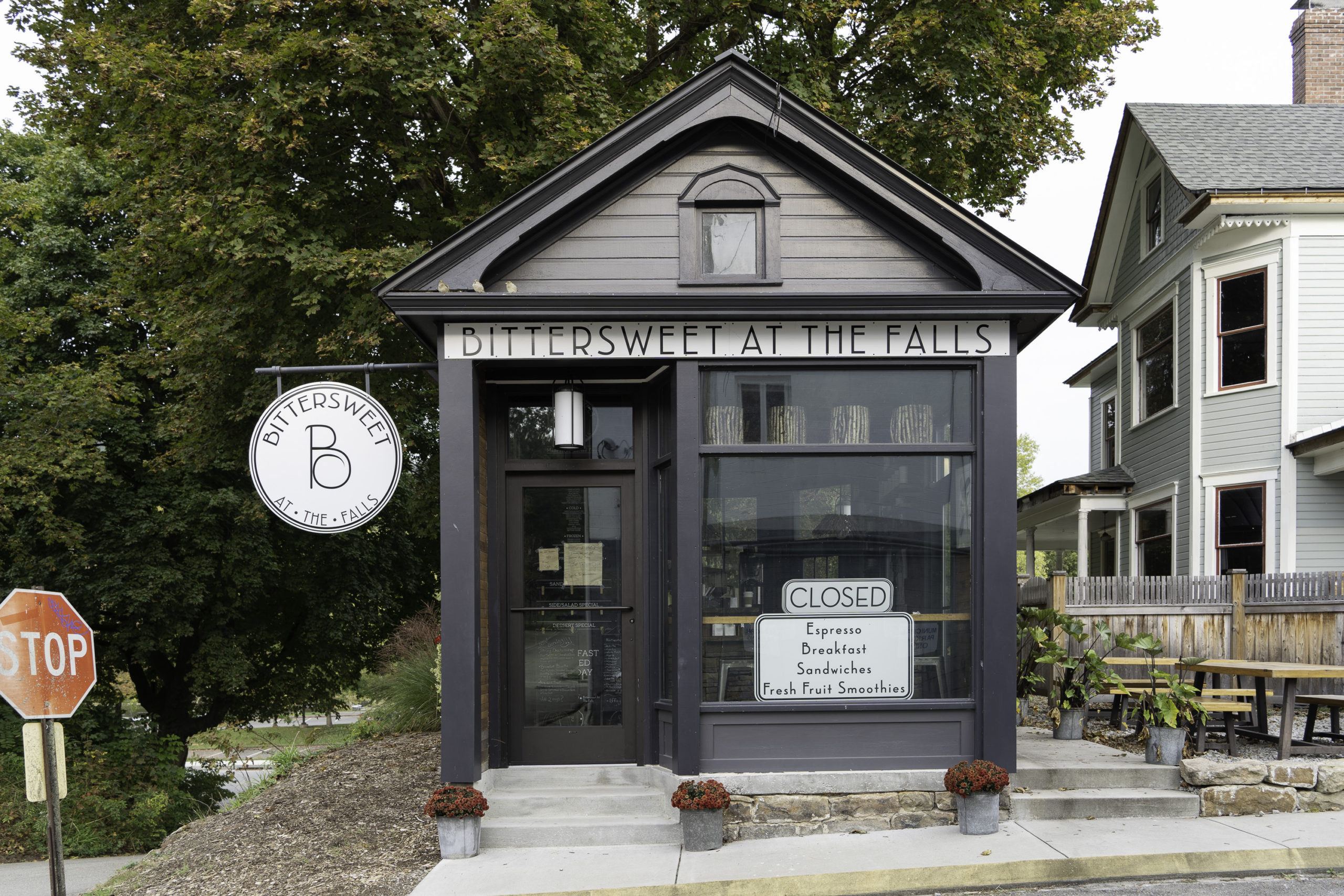
This nicely designed espresso bar, Bittersweet at the Falls, sits on one of Ohiopyle’s side streets. The town has a riverside park and is a center for river-oriented activites such as tubing and kayaking.
Day 3, at the Salisbury Viaduct. It’s 1,900 feet long and over 100 feet high as it crosses the Casselman River Valley. As is true of many of the bridges along the trail, it was built wide enough for two set of rails, but only ever had one. The greens and browns of the rusting spans merge into the landscape of fields and trees below. Windmills line the distant ridge.
A set of rail tracks curve beneath the Salisbury Viaduct. The repetitive textures of the rails and ties relate in some way to the corn rows beyond. Each has their own type of order.
Looking back from the eastern end of the Salisbury Viaduct, the span and supporting trestles and railings recede to a point in the distance – a mesmerizing one-point perspective.
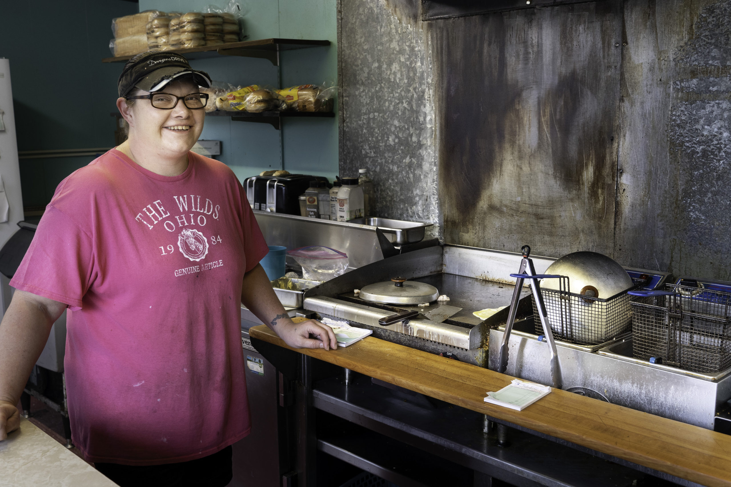
At the beginning of Day 4. At Donges Drive-In Motel in downtown Meyersdale (eight rooms, four over four) the little grill counter/restaurant was a welcome surprise. Shane cooked breakfast for us, cutting up potatoes on the spot to make home fries.
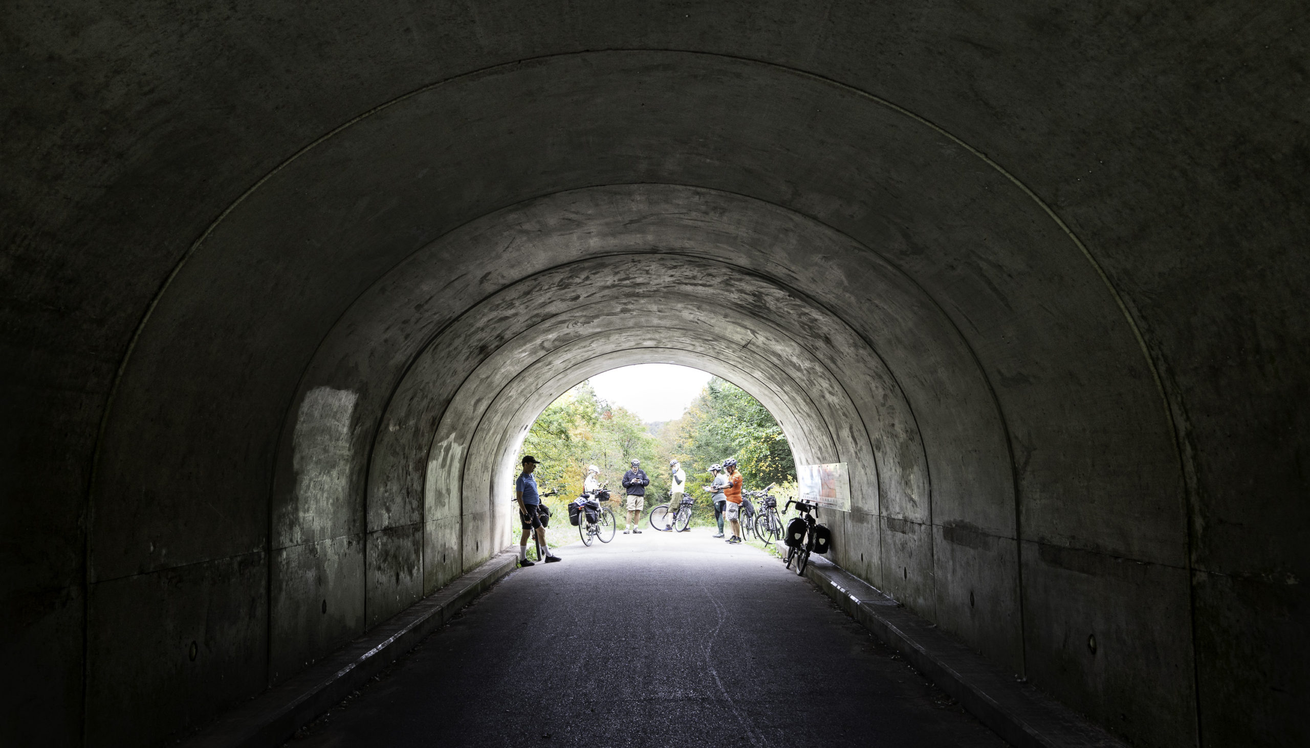
23 miles from the the end of the Passage trail in Cumberland, MD a short tunnel marks the Eastern Continental Divide. On one side of the divide waters flow to the Mississippi and Gulf of Mexico. One the other side waters flow to the East Coast and the Atlantic. From this point on it was a mild downhill grade all the way to Cumberland – nice!