This past week I rode my bike down most of Shenandoah National Park’s Skyline Drive, a beautiful narrow parkway that winds for 105 miles along the crest of the Blue Ridge Mountains on the east side of the Shenandoah Valley. I had a good stretch of weather for doing the ride over several days, and I camped along the way in the campgrounds that the Park Service operates.
I’ve ridden my motorcycle down Skyline Drive many times, attracted by its peacefulness, its landscaped roadsides and overlooks, and its views down into the Shenandoah Valley to the west, and to the Piedmont to the east. At its southern end it connects with the northern end of the Blue Ridge Parkway, which continues for almost another 500 miles, down through Virginia and North Carolina towards Georgia. Three years ago I rode my motorcycle all the way down and back both routes in four days. I left Washington, DC on a Thursday and was back on a Monday – almost 1,600 miles. This year, in the same amount of time, I rode down Skyline Drive logging just a fraction of those miles, but all on my own power! Maybe someday I’ll progress to walking the route on the Appalachian Trail, which runs roughly parallel to the parkway in Shenandoah Park.
Skyline Drive was designed and built in the 1920s and 1930s, to be a central feature of the new Shenandoah National Park. In the 1930s the Civilian Conservation Corps, formed to employ young men during the Great Depression, helped construct the road and its landscaping. It’s hard to imagine anything like Skyline Drive and the Blue Ridge Parkway being built today, cutting their way along the ridges of scenic mountains – but the roads were engineered to fit into the terrain so beautifully you wouldn’t think to criticize their existence now. They fit right in. A tree canopy covers much of Skyline. Deer are all over, and black bear are around – I’ve seen cubs scrambling across the road twice. This week I saw a coyote. With the wildlife that’s in view it’s evident you are in their home.
When you are responsible for powering your own ride along the route you gain new insight into the ups and downs of Skyline Drive. On my first day I rode 30 miles. It doesn’t sound like much to serious bikers, but over that distance I had to gain about 5,000 feet of elevation – almost a mile! In all I rode about 90 miles in beautiful weather over three days. I finished my ride at its southern entrance, just in time to escape heavy downpours from the remnants of Hurricane Laura, which was sweeping across Virginia on my car ride back to DC.
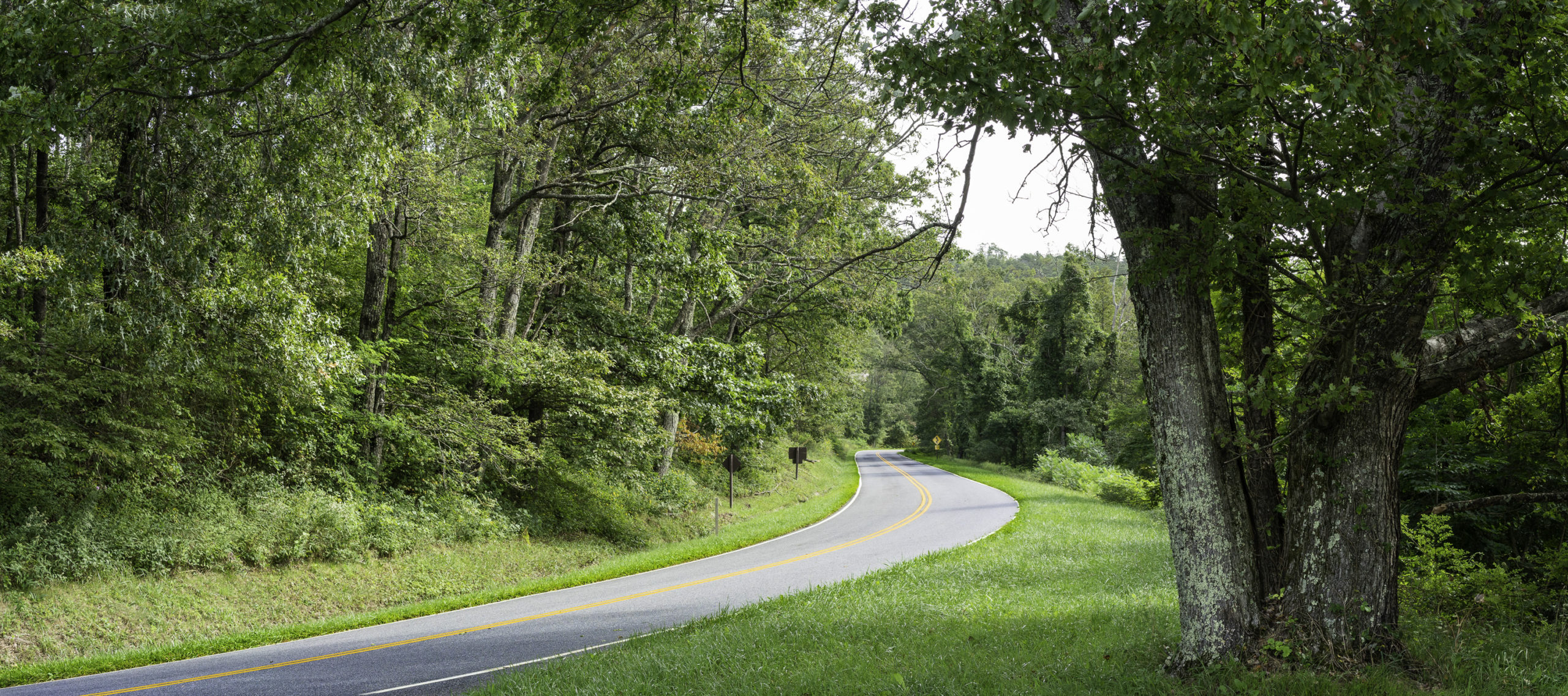
A typical scene along Skyline Drive: A nice long view, of the Shenandoah Valley to the west or the Piedmont to the east; a peaceful curving stretch of road disappearing into trees; and a low rock wall stretching along the road. The original timber guardrails were removed in the 1950s.
The road was engineered to blend into the natural terrain of the Blue Ridge, gracefully winding back and forth around the shoulders of its mountains and along its slopes. The Park Service keeps the grass cut on the roadsides, nicely blending the parkway in with the surrounding forest.
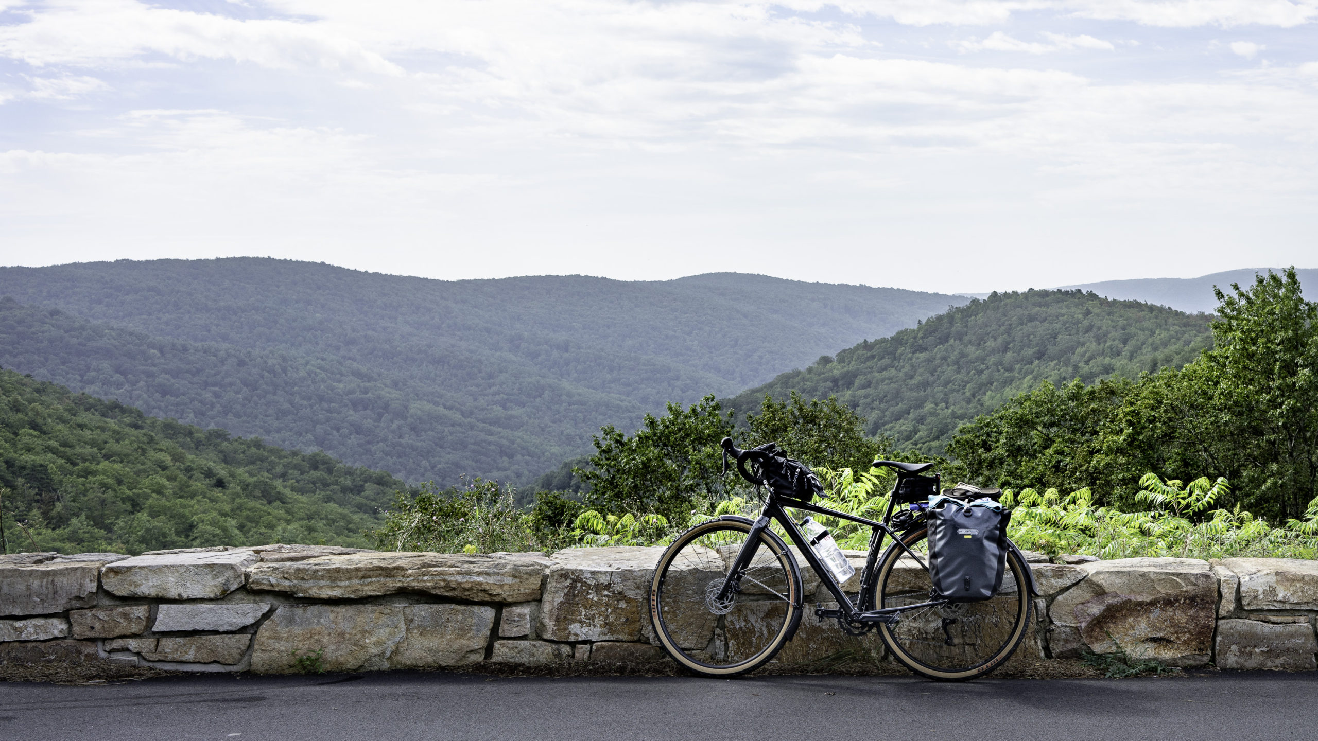
I’ve had this bike for about a year. Its frame has the geometry of a road bike, but it can take wider tires for riding on rougher surfaces, like the gravel on rail trails. I bought the fenders to put on in case I might be riding in rain – otherwise they’re off. Disk brakes were nice to have on Skyline Drive’s long downhills – they did not fade. I stowed just about everything in rear panniers – the tent and campsite things on one side, and clothes and food on the other. I strapped a handlebar bag on the inside of the bar for my camera – it just clears my knees when riding. I also rode with a light backpack designed for biking that has a 2.5 liter hydration bag/tube – that’s where I carried my rain gear and lunch.
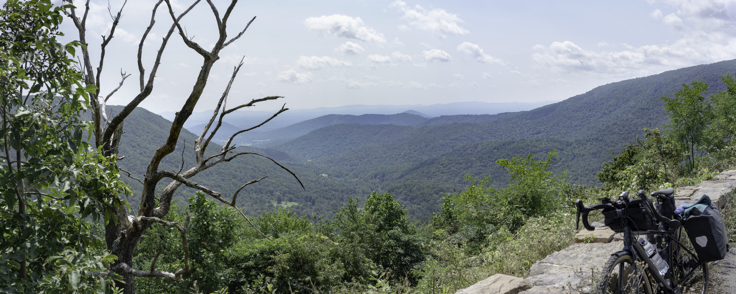
In this picture you can get an idea of why the mountain range is called the Blue Ridge. In the distance you can see the blue haze that’s characteristic of these mountains. According to Wikipedia, “Trees put the “blue” in Blue Ridge, from the isoprene released into the atmosphere.” You occasionally see dead bare trees along the overlooks, like the one on the left in this image. I suspect the Park Service may leave those for the large falcons and other birds of prey that like to perch and watch for their next unsuspecting meal.
This is a view west into the Shenandoah Valley. The tree on the right caught my eye – its beautiful silvery limbs and small light foliage were a contrast to the darker forest around it. Thousands of trees were planted in landscaping along the parkway when it was originally built. This may be one of them.
All three of the campsites that I set up in were nice spots. This one was down a short dirt path on a hillside that included a beautiful little glade of bright green grasses adjacent to the site – nice! The metal box on the left is called a “bear box” – a place to stow food for hikers and bikers that don’t have a vehicle to keep food supplies safe from black bears. I didn’t see any bears on this trip. I did have deer wandering through my site one night – I could hear them munching on the grasses right next to my tent as they slowly moved through.
There are a lot of trails throughout Shenandoah National Park, including the Appalachian Trail (the “A.T.”), that runs about 2,200 miles from Maine to Georgia. I’ve hiked on a lot on the A.T., particularly in New Hampshire’s White Mountains. I’ve thought about hiking the whole route, but I really like getting above treeline when I hike, and most of the ground the A.T. covers is through forest. This view, of a 100-foot deep gorge on a trail near one of my campsites, is not far from the A.T. A seasonal waterfall that spills over the rock face on the left is the highest in Shenandoah Park.
The edge of the gorge had some nice outcroppings for taking in the views. You have to approach these viewpoints with care – it was a sheer drop!
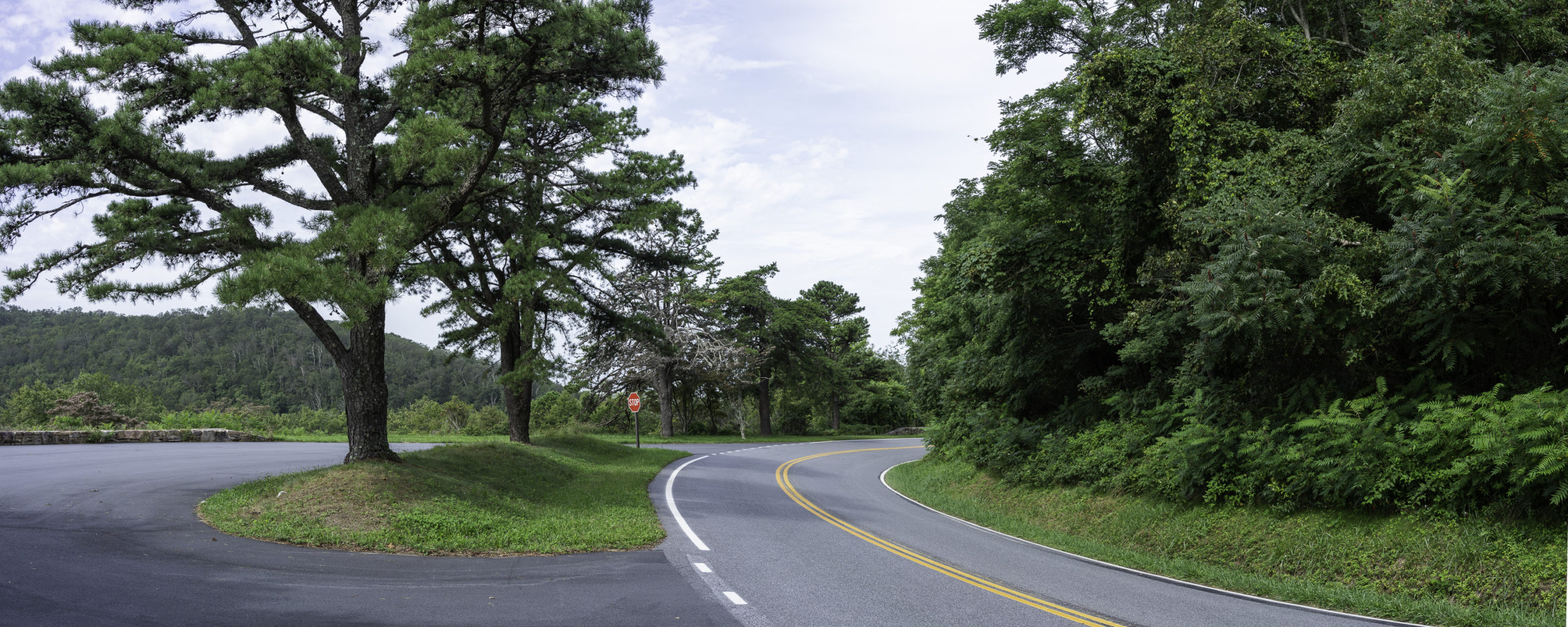
Skyline Drive is constantly bending back and forth in graceful curves. The route has frequent overlooks, like this one on the left, where you can pull off the road and park you car (or motorcycle, or bike, or bottom) and take in the views.
It’s morning in this photo, and I’m mostly packed up and getting ready to start a day of riding. My breakfast of muesli is soaking in a ziplock bag on the perforated metal picnic table. My blue tarp ground cloth for the tent is draped over the bear box behind the bike – drying off before I fold it up and strap it to the rack on the back of the bike. Each time that I set up the tent on this trip it was on the verge of raining, from one of those late afternoon storms. The weather throughout the week was great for riding, though, and I arrived at the southern end of the parkway to meet a friend for a ride back to DC, just before rain started pouring down from remnants of Hurricane Laura – good timing!